
![]()
沖縄県平和祈念資料館
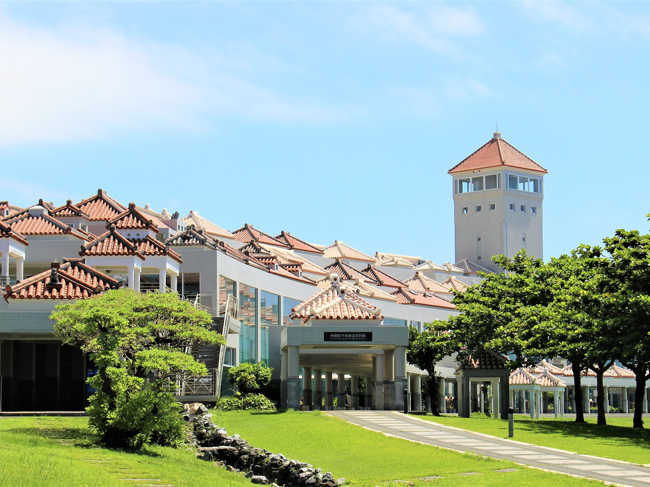
沖縄本島南部の平和祈念公園内にある資料館。戦争の残酷さと平和の尊さを民衆の視点から訴えるという主旨で、沖縄戦に関するさまざまな資料を展示している。2階の常設展示場は、「沖縄戦への道」「鉄の暴風」「地獄の戦場」「証言」「太平洋の要石」の5つの展示室に分かれ、沖縄の人々の視点から見た沖縄戦の実相を後世に伝える展示をしている。未来を展望するゾーンとして1階には子ども・プロセス展示室があり、18カ国18人の子どもたちの生活の様子を通して、世界の多様性を学べる。1階の利用は無料。
Appearance
沖縄平和祈念像
The information provided reflects the details available at the time of the survey.
Please note that facility details may change due to the facility’s circumstances, so please check for the latest information before visiting.
This content has been translated using machine translation.
Information provided by: JTB Publishing
The content uses an automatic translation service, which is not always accurate.
The translated content may be different from the original meaning, so please understand and use it.
沖縄本島南部の平和祈念公園内にある資料館。戦争の残酷さと平和の尊さを民衆の視点から訴えるという主旨で、沖縄戦に関するさまざまな資料を展示している。2階の常設展示場は、「沖縄戦への道」「鉄の暴風」「地獄の戦場」「証言」「太平洋の要石」の5つの展示室に分かれ、沖縄の人々の視点から見た沖縄戦の実相を後世に伝える展示をしている。未来を展望するゾーンとして1階には子ども・プロセス展示室があり、18カ国18人の子どもたちの生活の様子を通して、世界の多様性を学べる。1階の利用は無料。
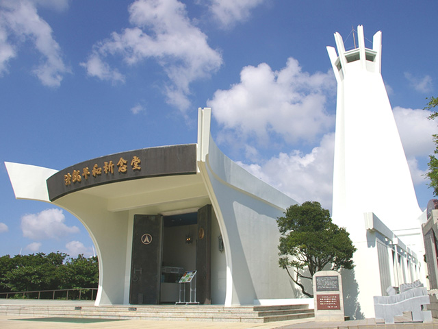
沖縄戦終焉の地である糸満市摩文仁に平和祈念公園として整備され、恒久平和への願いを発信する拠点となっている。園内には、沖縄県平和祈念資料館や、平和の礎[いしじ]、沖縄平和祈念堂、国立沖縄戦没者墓苑や各県慰霊塔など心に刻みたい見どころが多い。公園案内所にはWi-Fiフリースポットあり。園内EVバス一乗車ごと1回100円(土・日曜、祝日)。

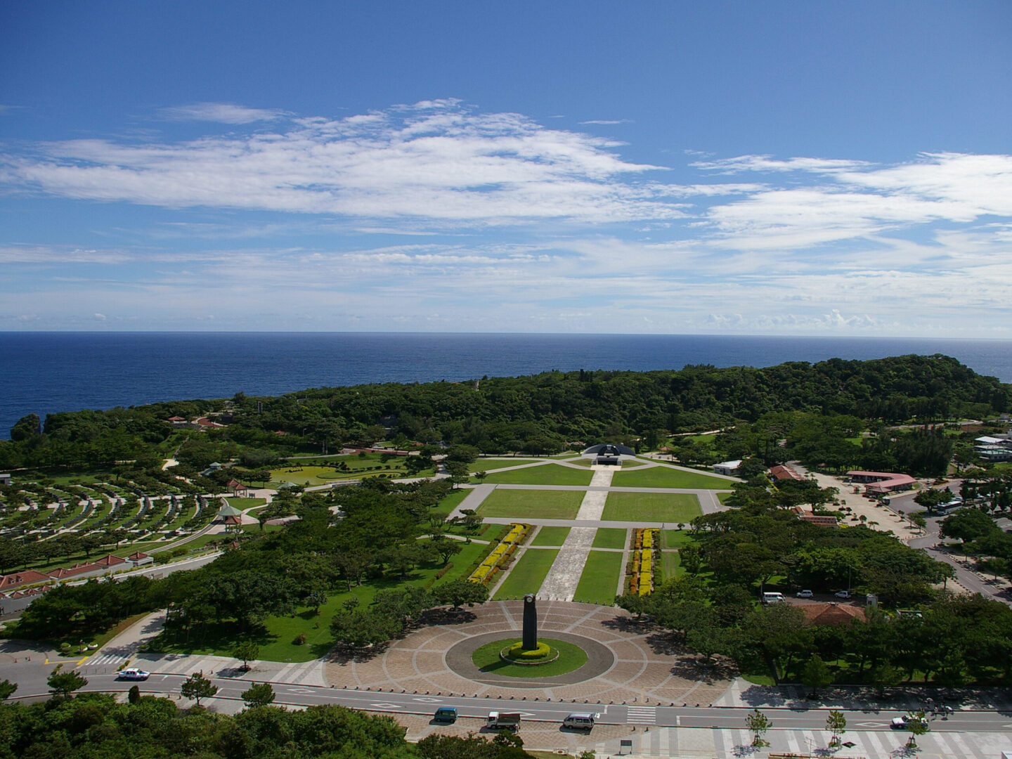
平和祈念公園内。沖縄戦最後の激戦地となった摩文仁の丘周辺には、その悲劇と恐怖の時代を忘れないよう、多くの慰霊碑が立ち並ぶ。丘の上には、各地に安置されていた戦没者の遺骨を納骨合祀した国立沖縄戦没者墓苑や各県の慰霊塔の碑があり、摩文仁の丘の麓には、平和・友情・師弟愛の思いを込めて建てられた3人の少年の像が立つ。そのすぐそばにあるのが沖縄師範健児之塔。沖縄戦で戦死した沖縄師範学校男子部289名と、学校長ほか職員17名が祀られている。黎明之塔は第32軍司令官・牛島満中将と軍参謀長・長勇[ちょういさむ]中将が、その最後までこもっていたという第32軍司令部壕の上に立つ。
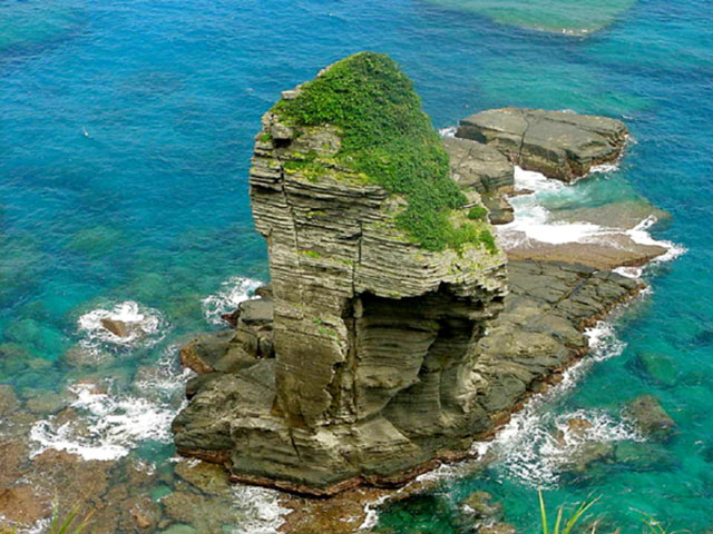
Among the islands of Yonaguni, which are surrounded by sheer cliffs, the east-south is the area with the most severe and masculine landscapes. It is dotted with strange rocks that have been created over time due to the rough open sea. Close to Higashizaki, there is the Sannine stand, which shows the fault, which is divided into several layers, as a rock face. From the observation deck, the warship rock, which looks like a warship as its name suggests, is still washed by the waves. About a five-minute walk from Saint-Ninudai, there is a standing rock with a legend that a young man who could no longer descend from the top of the rock was helped by God.
A waterfall with a height of about 20m appears when you drive about 5 minutes into the mountains from the National Highway No. 58 Ikuta intersection.
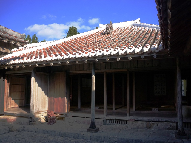
It is a royal farm house built about 280 years ago, and has been spared the war disaster of the Okinawa War to completely leave the private house structure of the Ryukyu Dynasty period. Since he was a local head of state around the year of Kyoho 10 (1720), he also has a stately status as a form of a shabby house. Other features include kitchens with low roofs to use the attic called tungwa for storage, and pig huts called fools. The influence of medieval Japanese houses and Chinese architecture can be seen everywhere, telling the life of a wealthy farmer in the Ryukyu period.