
![]()
ASMUI -Spiritual Hikes
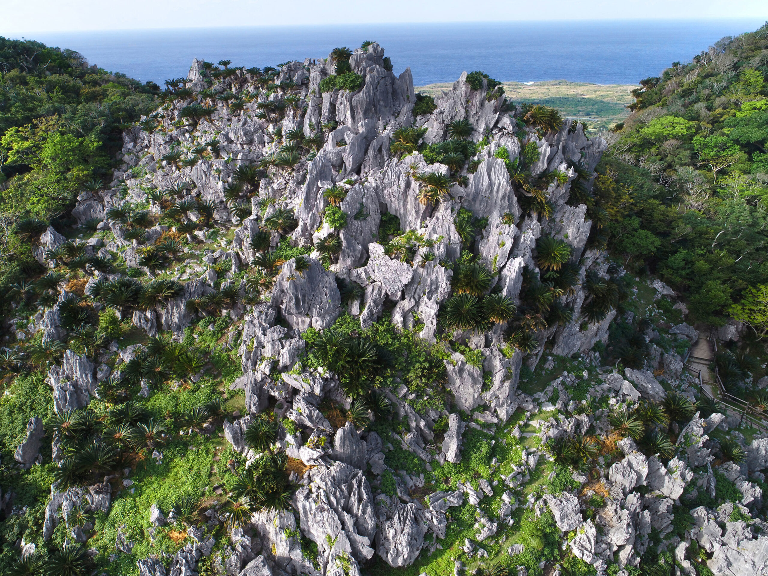
沖縄本島最北に位置する四連の岩山 「安須森[あすむい](辺戸御嶽)」は、沖縄最古の歴史書『中山世鑑』に、琉球開闢の神が最初につくった聖地とされる霊山。数多くの拝所が点在するシャーマンたちの祈りの場であり、杜の主ともいわれる巨大ガジュマル「御願[うがん]ガジュマル」があるなど、スピリチュアルな気に満ちている。そんな特別な杜に足を踏み入れると、この地に潜む物語を感じることができる。
The information provided reflects the details available at the time of the survey.
Please note that facility details may change due to the facility’s circumstances, so please check for the latest information before visiting.
This content has been translated using machine translation.
Information provided by: JTB Publishing
The content uses an automatic translation service, which is not always accurate.
The translated content may be different from the original meaning, so please understand and use it.
沖縄本島最北に位置する四連の岩山 「安須森[あすむい](辺戸御嶽)」は、沖縄最古の歴史書『中山世鑑』に、琉球開闢の神が最初につくった聖地とされる霊山。数多くの拝所が点在するシャーマンたちの祈りの場であり、杜の主ともいわれる巨大ガジュマル「御願[うがん]ガジュマル」があるなど、スピリチュアルな気に満ちている。そんな特別な杜に足を踏み入れると、この地に潜む物語を感じることができる。
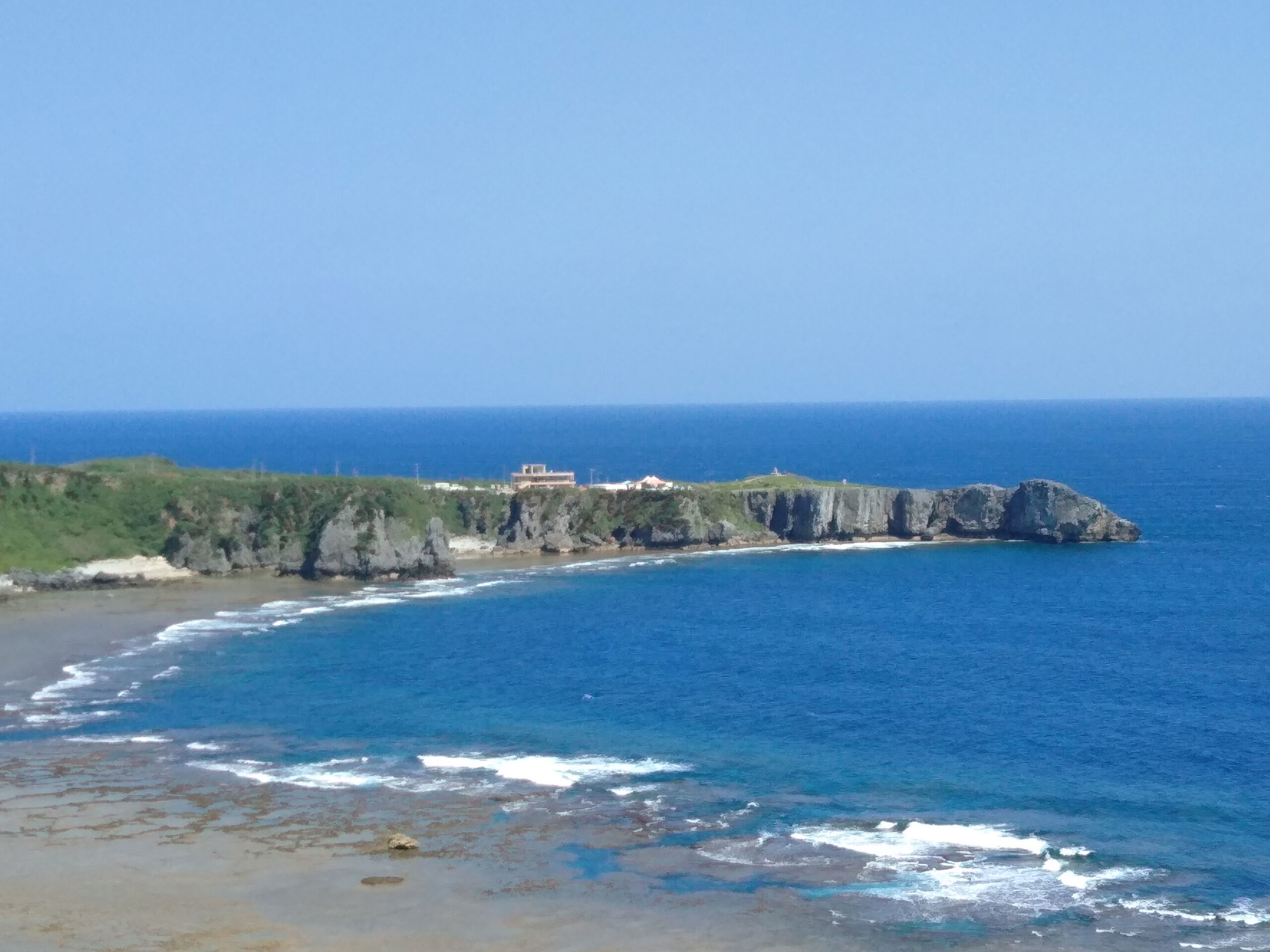
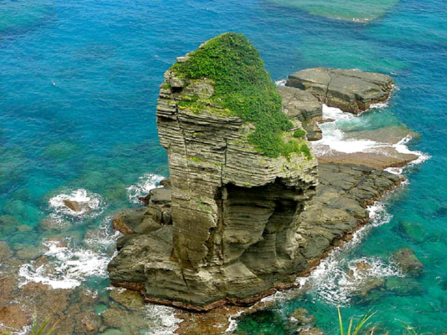
沖縄本島北端に位置し、隆起サンゴの断崖がそそり立つ景勝地。岬の先端に立つと、左手に伊是名島や伊平屋島、北の海上には与論島も見渡せる。与論島を含む奄美諸島は昭和28年(1953)に本土に復帰したが、沖縄の本土復帰が実現するのは昭和47年(1972)。先端付近には米軍統治時代に、与論島とこの岬でかがり火を焚き、本土復帰を訴えた海上集会を記念して立てられた祖国復帰闘争の碑がある。岬の背後にそびえる岩山は、辺戸岳。辺戸御嶽ともいわれ、琉球の祖先アマミキヨが沖縄の島々を創ったときに最初にこしらえたという伝説が残る霊地。
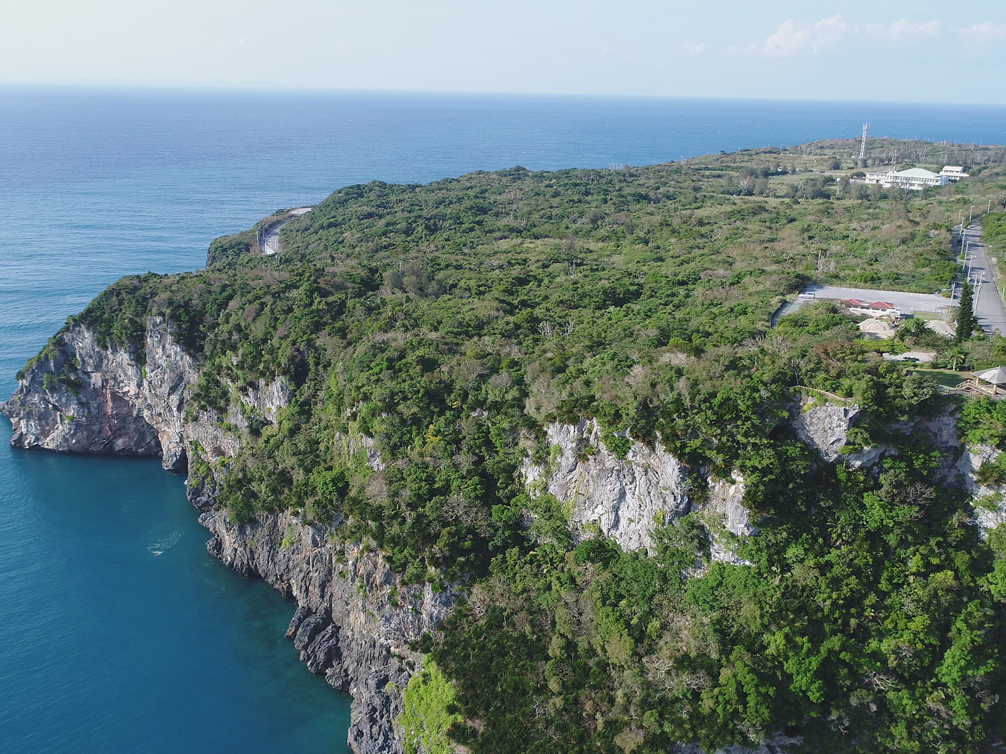
宜名真[ぎなま]の集落から山道を上る旧道沿いに続く、高さ80mもの切り立つ断崖。バンタとは崖の意で、束ねた茅を崖から投げ込むと、強風に打たれてバラバラになることからこの名がついた。茅打ちバンタに向かう道は、曲がりくねった急な坂道で、ここで行き会うとどちらかが下がって道を譲らなくてはならなかったので、戻り道とも呼ばれていた。崖の上の展望台から眼下を見下ろせば、思わず目もくらむ高さを実感できる。先に目を向けると、澄んだ海原に浮かぶ伊平屋[いへや]島や伊是名[いぜな]島が見渡せる。
Among the islands of Yonaguni, which are surrounded by sheer cliffs, the east-south is the area with the most severe and masculine landscapes. It is dotted with strange rocks that have been created over time due to the rough open sea. Close to Higashizaki, there is the Sannine stand, which shows the fault, which is divided into several layers, as a rock face. From the observation deck, the warship rock, which looks like a warship as its name suggests, is still washed by the waves. About a five-minute walk from Saint-Ninudai, there is a standing rock with a legend that a young man who could no longer descend from the top of the rock was helped by God.

A waterfall with a height of about 20m appears when you drive about 5 minutes into the mountains from the National Highway No. 58 Ikuta intersection.
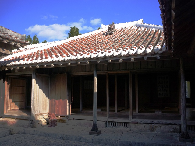
It is a royal farm house built about 280 years ago, and has been spared the war disaster of the Okinawa War to completely leave the private house structure of the Ryukyu Dynasty period. Since he was a local head of state around the year of Kyoho 10 (1720), he also has a stately status as a form of a shabby house. Other features include kitchens with low roofs to use the attic called tungwa for storage, and pig huts called fools. The influence of medieval Japanese houses and Chinese architecture can be seen everywhere, telling the life of a wealthy farmer in the Ryukyu period.