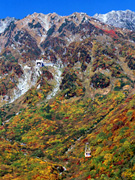
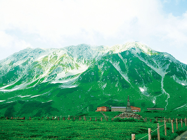
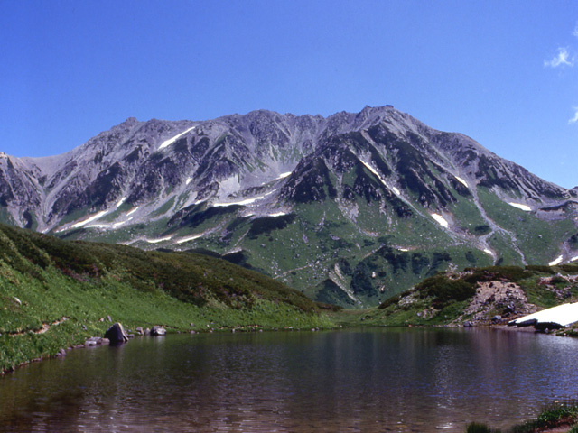
Archives: Travel Post

Tambo flat

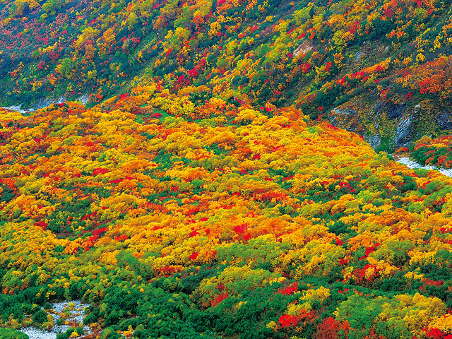
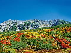
The gentle large slope of the eastern face of Tateyama Renfeng is called Tambodaira. The whole view can be seen from Kurobedaira, but the view from the ropeway is more impressive. deciduous forests such as dake birch, rowan, and plant maple show color by season. Especially the fresh fresh green of June and the vivid autumn leaves of early October cannot be missed. Also, three-stage dyeing of snow and autumn leaves and green may be seen depending on the climate of the year.

Taira Kurobe

The Tateyama Kurobe Alpine Route is a mountain sightseeing course that crosses the Northern Alps without walking to Bijodaira, Midagahara, Murodo, Daikanmine, Kurobedaira, and Lake Kurobe using various vehicles. Kurobedaira, the transfer point between the Tateyama Ropeway and the Kurobe Cable Car, is a scenic spot located at an altitude of 1828m. In addition to giving a bird's-eye view of the majestic Northern Alps, the Kurobedaira Garden and the Alpine Botanical Garden have been established, and you can also enjoy a small walk when waiting for a transfer.

Black water spring

At the time of the construction of the Kurobe Dam, water is drawn from the fracture zone of the Kanden Tunnel, which was difficult to break through. It is located at the entrance of the Kurobe Dam Observation Deck, the Kurobe Dam Rest House, and at the middle of the ground stairs from Kurobe Dam Station to the Kurobe Dam Observation Deck.

Lake Kurobe

Lake Kurobe, which collects the melting water of the Northern Alps with a series of mountains of 3000m, is a dam lake created by the Kurobe Dam. Surrounded by primeval forests such as beech, the emerald green lake is impressive. From the west shore, the Lake Kurobe tour boat Garbe operates around the lake in 30 minutes. The lake surface elevation is the highest at 1448m, and the wind across the lake is cold even in summer. From the end of September to the beginning of October, the beech forest on the shore of the lake becomes yellow, adding vividness to the mystery. You can also enjoy forest bathing if you walk on the promenade that is maintained on the shore of the lake on the west shore.

Emmadai (Emmadai Observation Deck)

A hill overlooking Jigokuya, right near Mikurigaike Onsen, north of Mikurigaike Pond. There is also the name of "Jigokudani Observation Deck", so it is a recommended spot where you can see the creepy landscape of Jigokudani up close. In front of the mountain, you can also see the Yamazaki curl (the hill valley), which was cut off by the glacier on the middle of the mountain, and the terrain is easy to understand from here.

Murodo Taira Recreation Tower

The Hōjō Intō (Bōyō Intō) stands in the Murodō area, a corner of Murodōdaira. It was built to serve people who died in distress at Murodo, such as worshipers and climbers of Tateyama, and is a large service tower with a height of about 3m. Until mid-May, they may not be seen buried by snow.

Jigokudani

A streaks of air rising in the desolate valley where the hydrothermal water springs, and the smell of sulfur rushes, Jigokaya is a symbol of the "hell" of the Tateyama faith. It was one of the popular walking courses of Murododaira where the promenade was maintained, but since 2011 (2011), the increase in the concentration of toxic sulphite gas has been confirmed, and the aging of automatic alarm equipment has also led to a ban on traffic. Replacement sidewalks are being improved, but until new sidewalks are maintained, let's take a look at the desolate scenery of Jigokudani from the Emmadai Observation Deck on the north side of Mikurigai Onsen.

Raitosawa

Tateyama's signature fall foliage spot. From Murodo Terminal, go north through Mikuri-gaya Pond and Rindo Pond to the open ground. Raitosawa is also known as mountain climbing bases such as Okudai Nidake, Tateyama Sanzan, and Tsurugu-dake. There are two accommodation facilities and the Raitosawa campsite. From late September to early October, the earth is colored in colorful autumn colors such as rowan red, green maple yellow, and green pine.

Gendow Pond (Rindo Pond)

A smaller pond than Midori Pond, just off Raitori Zhuang. It is located at an altitude of 2354m, the water depth is about 1m, and the rock at the bottom of the lake is exposed to the surface of the water. As the name implies, the flowers of the gentian bloom from mid-July to the end of August on the surrounding slopes. It is a small flower of about 10cm in height, such as a mountain gendo or a mountain gendo, so as not to overlook it. They may also be thirsty in the summer.

Midoriga Pond

The crater lake on the east side of Mikriga Pond. The water depth is shallow, about 1.6m. When you stand on the shore, you can see the rocks at the bottom of the water, and you can feel the height of transparency. The figure of Tateyama is clearly reflected on the quiet surface of the water, and the beauty of remaining snow and autumn leaves is further enhanced. It is also reported that the practitioners slid the ink used for the sutra in this water. There is a promenade on the banks of the pond, and there are also wet plants and alpine plants in the surrounding area, such as Wai-wai-wai-wo and Yotsuba-shiogama.

Contact Us: Business & Personal Inquiries

By proceeding, you agree to our Terms of Use And confirm you have read our Privacy Policy .

Notes

· We are available for inquiries 24 hours a day. Responses will be provided between 9:00 and 18:00 (including weekends, public holidays, and year-end/New Year holidays).
· Depending on the nature of your inquiry, it may take some time for us to respond.

RURUBU & ALL WAY JAPAN
Privacy Overview

This website uses cookies so that we can provide you with the best user experience possible. Cookie information is stored in your browser and performs functions such as recognising you when you return to our website and helping our team to understand which sections of the website you find most interesting and useful.